SARKARIPROPERTY.com
Closing soonToday ADA Ajmer e-Auction November 2026 to January 2027 EMD closes, first lotsToday JDA Jaipur e-Auction November 2026 EMD closes, first lotsToday JDA Jodhpur e-Auction October-November 2026 EMD closes, first lots2 days KDA Highway City Part-4 Residential Plots 2026 Registration endsAll closing dates

Bhiwadi layout plans and colony maps

RHB layout plans for Bhiwadi colonies: Aravali Vihar, Bhiwadi, as the authority published them. 2 sheets, each at full size with its brochure page or on the authority's own site; nothing is redrawn. Use these to find where a plot sits before you register for a scheme.

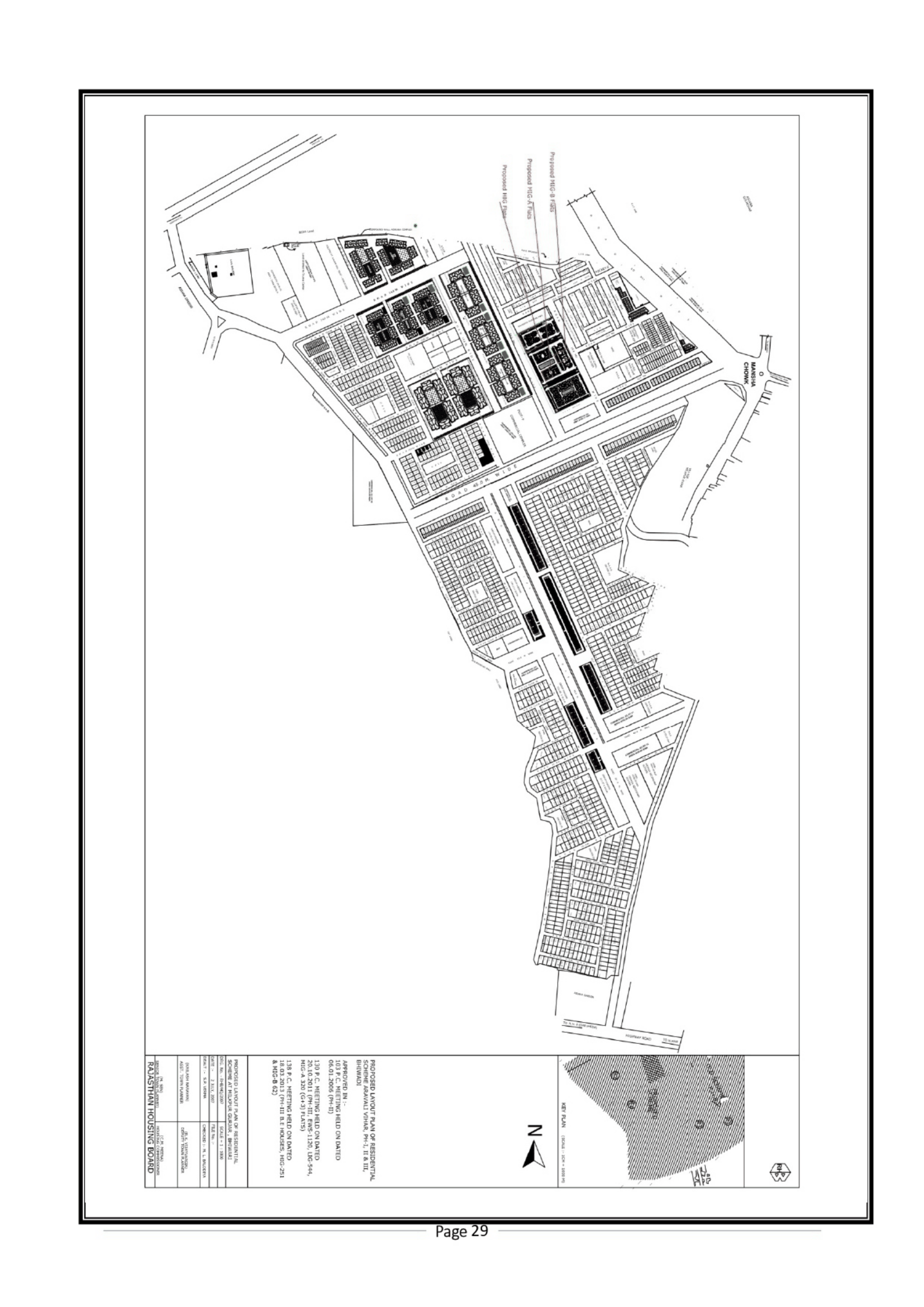
RHB: Site plan, Aravali Vihar, Bhiwadi

Bhiwadi master plan

Bhiwadi master planRHB's own plan for the townOpens on the authority's own portal link being read
2 of 2 sheets

Aravali Vihar, Bhiwadi2 sheets · RHB

77 flats on sale, from ₹38.50 L
Site plan, Aravali Vihar, Bhiwadi
ResidentialSheet p. 30PNG 470 KB
Location on a satellite view, Aravali Vihar, Bhiwadi
ResidentialSheet p. 31PNG 765 KB

Questions about Bhiwadi layout plans

Where do these layout plans come from?

From RHB's own scheme brochures and notices. Each sheet carries the page number of the brochure it was taken from. SarkariProperty crops and files the drawings; it does not redraw, recolour or annotate them.

Can I find my plot number on these maps?

On the pocket, site or sector sheets, yes: they are drawn at a scale where the plot numbers can be read. Open the colony's map page to zoom in on a sheet.

Where are the flat plans and floor plans?

On the scheme page of the property they describe, beside its price and area. This page holds the maps of the colonies, their pockets and sites.

Why is a drawing here for a colony with nothing on sale?

Because the authority published it, and a drawing is a record of the place rather than of one auction. It stays here after a scheme closes, which is what a buyer of a resale property there also needs.

Where is the Bhiwadi master plan?

On RHB's own portal. This site has not linked it yet; this page holds colony layout plans.

How to read an authority's layout plan

Whole-colony layout

  • The land-use legend: residential, group housing, commercial, institutional, green, roads
  • The area statement at the corner: gross, net, and how much goes to each use
  • Pocket, block or sector letters are how the authority names parts of the colony; plot numbers hang off them

Pocket and site maps

  • Where a numbered plot sits against the main road, the park and the roundabout
  • Road widths are marked in metres; a wide road is a colony spine, a narrow one a lane
  • Land marked "unacquired" may still be in dispute; a plot beside it may wait for its road

Where the flat drawings are

  • This page holds the maps: the whole colony, its pockets and site plans
  • The drawing of one flat or one floor sits on the scheme page that sells it, next to its price and area
  • Super area includes the share of the stair and lobby; carpet area does not. The notice says which figure it prices